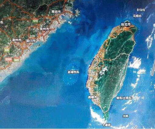
We investigated the metabolic states of plankton communities in the Taiwan Strait and the northern South China Sea by measuring gross primary productivity (GPP), community respiration (CR) and bacterial production (BP) at 16 stations in these areas. GPP averaged 106.6 mmol O2 m-2·d-1 with a standard error of 7.51 mmol O2 m-2·d-1. CR averaged 131.1 mmol O2 m-2·d-1 with a standard error of 5.95 mmol O2 m-2·d-1. Net community productivity varied from -179.0 to 377.6 mmol O2 m-2·d-1with a median value of -40.4 mmol O2 m-2·d-1. Our results showed that the area affected by Qiongdong upwelling was autotrophic. In the areas affected by the Pearl River discharge, the plankton community was also autotrophic. By contrast, other areas including the Taiwan Strait nearshore waters and the South China Sea open waters were heterotrophic. Therefore, community respiration was not entirely determined by the local primary productivity in the study areas. Our results suggest that the spatial transport of organic carbon plays an important role in determining the metabolic state of the plankton community.
In this study, we conducted barotropic detiding of the summertime shipboard ADCP (SADCP) dataset in the southern Taiwan Strait (TWS) from June to September during 2004-2013, employing the widely used spatiotemporal fitting by the least squares method (STF-LSM). The results show that the mean flow derived from STF-LSM and that derived from averaged vectors by dataset gridding both flowed northeastward. Moreover, these two mean flows had similar spatial distribution patterns of strong and weak flows, but their maximum velocities were slightly different: 0.46 and 0.34 m·s-1 for the former and the latter, respectively. Besides, the strong currents (about 0.3 m·s-1) were characterized by the narrow mainstream confined around the depth of 30 m off the sea at Dongshan and Longhai as well as the Taiwan Bank (TWB) with drastic topographic change, whereas the weak currents (less than 0.1 m·s-1) were mainly distributed in the central TWB. Estimation of the volume transport based on the above mentioned mean flows revealed similar results, up to (0.71±0.24) ×106 m3·s-1. The strong M2 tidal currents derived from SADCP were near the TWB and extended to the offshore of Dongshan, with a maximum M2 current amplitude as large as ~0.64 m·s-1, which was located in the TWB. The cotidal chart for M2 currents demonstrates the characteristics of progressive wave, which was delayed successively from the southwest to the northeast along the direction of the tidal wave as the wave propagated (about 2 h). Besides, there was a boundary line along northwestward to southeastward direction with ellipticity equal to zero at the offshore of Dongshan. The M2 currents rotated counterclockwise in the southern region of this boundary line and clockwise in the northern region.
In order to study the trend, shape and tectonic setting of the Changle—Nan’ao fault and Binhai (littoral) fault, the Earthquake Administration of Fujian Province expanded seismic sounding into the southwest Taiwan Strait using large volume air-gun arrays and Ocean Bottom Seismometers (OBSs), which formed a relatively complete observation system in conjunction with onshore explosions and portable seismometers. In this paper, we introduce in detail the six profiles collected between 2013 and 2015, including the observation system, acquisition parameters, and data preprocessing. Due to rational choice of shooting parameters and receiver position, a variety of seismic phases, including Pg, PmP, Pn, Sg, and SmS, can be clearly identified in most common receiver gathers of the portable seismometers and OBSs. By multiple shooting the air-gun array at fixed site, we obtained several stacked common shot gathers, of which the signal-to-noise ratios were as high as those acquisition with ton-level explosions. Compared with the data recorded by onshore seismometers, the data recorded by OBSs have a relative low signal-to-noise ratio, which probably means that the seabed in this area has a higher absorption. In light of low velocity and acute variety of deposition thickness in the southwest Taiwan Strait, we transfer the travel times, which were picked up on the common receiver gathers to shot domain, in order to avoid the errors of sediment model, which resulted in pseudo deep structures.
Time service system is very important for inverting velocity structure of underground media via traveltime tomography. Due to the lack of GPS time access, the time errors (including time service error and time keeping errors) of the Ocean Bottom Seismometer (OBS) mainly come from the inaccuracy of internal quartz crystal oscillator, affected by external environment changes and switching and other factors. The long term practice finds that, some Chinese-made OBSs have large time deviation when recording air gun signals and natural seismic signals. In this study, 53 Chinese OBS records obtained from the crustal structure sea-land exploration experiments in Fujian and Taiwan straits in 2019 were used for time service system correction. To obtain OBS time service error, the consistency test of uninterrupted acquisition before going to the sea, as well as the sloshing caused by the transport ship during transportation, are used to correct the timing error by cross-correlation. For the time keeping error, the deviation between the calculated actual sampling frequency and the theoretical sampling frequency is corrected. The time service system is corrected comprehensively by using naturally occurred earthquakes. It has been demonstrated that the corrected OBS data can improve the accuracy of time record and reduce the error of seismic phase identification and traveltime picking. At the same time, the results of this paper provide important reference for the widespread use of domestic OBS and standardization of domestic OBS data acquisition process.
Using the measured wave data in 2017 in the central Taiwan Strait, we analyze the basic features of wave, including spectral features, and their relationships with wind. The regression relationship among important characteristic wave parameters and the appropriate wave spectrum form are also investigated. The results are as follows. 1) The most frequently occurring wave direction is NE, and the strong wave direction is NNE. The monthly average significant wave height varies from 0.87 to 2.98 m. The wave height is the smallest in July and the highest in December. The wave period has similar inter-month change to wave height. 2) Mixed waves dominated by wind wave and single-peaked spectra make up the majority. The wave height is positively correlated with the wind speed as a whole. Strong wave is mainly generated by typhoons and strong northeast monsoon. 3) There are good linear correlations between mean wave period and most characteristic period parameters. The significant wave height and its corresponding wave period are strongly linearly related in the directions of NNE and NE. 4) Compared with the Jonswap spectrum, the Code spectrum 1 is more reasonable for the fitting of sea wave spectrum in this area. A spectrum in the form of Code spectrum 1 is given, which is fitted by significant wave height and spectral peak period. These results can provide references for ocean engineering design and numerical simulation of wave.
On the ocean bottom seismometer (OBS) wide-angle seismic record section, multiple signals with high energy and good continuity can often be detected. As same as the first arrival phases, multiple phases also can be real reflections of subsurface interfaces, they are generated by the same source signal. However, in the conventional OBS data processing, multiple signs are often deleted as invalid signals, just a few studies are concerned with their properties and applications. By processing the OBS data acquired from Line HXN01 in the southern Taiwan Strait, the secondary phases are identified and picked on eight seismic recording sections. Analysis of the measured data from OBS0106 station reveals that the waveform characteristics and particle motion trajectory of these two phases are very similar, the amplitude of the secondary Ps phases is greater than that of the first arrival phases. Then we determined that the secondary reflecting interface corresponds to the secondary Ps phases by Rayinvr ray tracing simulation. The fitting results of travel time shows that after adding the secondary phases, the ray-coverage density of the shallow sedimentary layer under the station is significantly increased, and the ray-coverage area is also significantly increased, which provides more information for the inversion of sedimentary structure. In addition, the inversion test before and after the addition of the secondary Ps phase was performed on the crustal structure of the theoretical model, and it was found that after the addition of the secondary Ps phase data, the interface depth error of the sedimentary layer improved significantly.