Dredged sediment is the main accumulative site of terrigenous pollutants going into the sea and main potential source of marine pollution. During the course of dredging and marine dumping, these pollutants in the dredged sediment can be released into the sea again, which can harm the marine environment. Therefore, treatment to turn the contaminated dredged sediment into harmless material has significant importance to the scientific management of marine dumping and the effective protection of the sea. The aim of this study is to review six main dredged sediment decontamination and treatment technologies, such as chemical and biosurfactant leaching, thermal treatment, electrodialytic method, ultrasound method, flotation method and bioremediation. The authors discuss the mechanisms of these technologies, effective factors, advantages and deficiencies. Combining several of treatment techniques such as physical, chemical and biological processes is a potentially effective way to treat the polluted dredged sediment in the near future.
Environmental pollution is serious in the Pearl River Estuary due to human activities and an increasing attention has been paid to the pollution in this region. This paper mainly reviews the eutrophication characteristics and the pollution patterns of persistent toxic substances (PTS, including heavy metals and persistent organic pollutants—POPs) in the water. Results in-dicate that the excessive input of nitrogen and phosphate has led to the high eutrophication in the water. Eutrophication plays an important role in triggering red tides. The coupling effect of the water stratification and eutrophication leads to the seasonal hypoxia in certain areas of the estuary. PTS mainly accumulate in sediment and organisms. The records of pollutants in sedi-ment cores reflect that pollutant accumulation in sediments is closely related to the rapid economical development of the Pearl River Delta in the past three decades. Finally, the critical issues of research are put forward on the environmental pollution of this area in the future, which include biotransformation of pollutants in tissues and bioaccumlation in food chain, the combined pollution of various pollutants in eutrophic water, mechanisms of microbial biodegradation of pollutants, pollution control strategy, among others.
The traditional mangrove land-based enclosure aquaculture model originated in the Pearl River Delta is a good example showing how mangroves can be used sustainably. This paper introduces three examples of mangrove land-based enclosure aquaculture at the mouth of the Pearl River Estuary. The first example is about the only operating traditional mangrove land-based enclosure for shrimp farming located in Mai Po Marshes Nature Reserve of Hong Kong and managed by WWF Hong Kong; its history goes back to the mid-1940s and its focus for management strategy has evolved from being commercial culture ponds to performance of multi-ecological functions including feeding habitat for piscivorous water birds, bird-watching, environmental education, as well as shrimp farming. The second example is the mangrove land-based enclosure for traditionally extensive aquaculture trial in the Dawei Bay on the Qi’ao Island of Zhuhai City, regarding measurement and analyses of relationship between the environmental condition change of water level and salinity and the mangrove community dynamics inside land-based enclosure. The third example is the mangrove planting-aquaculture system trial in the Shenzhen Waterlands Resort on the east coast of the Lingdingyang Estuary, including research on water purification function by mangroves. For mangrove protection and management and for marine pollution prevention in the Pearl River Estuary waters, the following suggestions are given: 1) Preventing resolutely the development model of clearing mangrove for aquaculture ponds, and disseminating and applying the eco-development model of land-based enclosure aquaculture or mangrove-friendly aquaculture; 2) Building new land-based enclosure aquaculture demonstration site in major mangrove regions, and exploring mangrove-friendly restoration model in aquaculture pond areas built by clearing mangroves; 3) strengthening relevant scientific research for maximizing comprehensive efficiency of mangrove land-based enclosure aquaculture.
Polybrominated diphenyl ethers (PBDEs) are a new type of persistent organic pollutants, which are widely distrib-uted in the marine environment and are harmful to marine organisms. It is, therefore, necessary to assess the effect of PBDEs on marine ecosystems. We introduce the chemical behaviors of PBDEs in seawater, review the accumulation of PBDEs in marine organisms including plankton, benthic animals and nekton, and present the transfer of PBDEs along the marine food chain (web) and their toxic effects. In addition, future research on the marine ecological effects of PBDEs is proposed.
Slow and ultraslow spreading ridges are the key areas for studying interplay among magmatism, tectonics, and hy-drothermal circulation comparing to the fast spreading ridges. Their complicated three-dimensional (3D) seismic structures are the basis of finding their tectonic dynamic mechanism. The research on the 3D seismic structures is reviewed in terms of slow spreading ridges in deep oceans, including its developing international research trend. The new experiments have detected a magma chamber or a melt body at a slow spreading ridge, same as at a fast spreading ridge. The 3D seismic survey for the first time was carried out on the southwest Indian Ocean Ridge from January to March in 2010. The key research aspects are then put forward based on these seismic experiment data. Its preliminary disposing result of the seismic data indicates that the high quality of the seismic data is the strong foundation of the 3D tomography. It is promising to make breakthrough in mechanism on ultraslow spreading ridges. The research will surely promote the Chinese status in the field of international ocean ridges.
Ocean dynamic processes in the South China Sea driven by the monsoon are characterized by seasonal and multi-scale variations, which have significant impacts on the evolution of marine ecosystems. Marine bacteria, as an important component of material cycle and energy flow in marine ecosystems, have active responses to the environmental changes associated with multi-scale dynamic processes. The interdisciplinary research on microbial community structures, their dynamic variation and associated physical processes is one of the hot issues in marine sciences, which combines marine microbiology, microbial ecology and physical oceanography. Based on the primary results of the Key Research Program, "Study on bacteria diversity coupled with the monsoon circulation in the South China Sea and significance in microbial oceanography" supported by the National Natural Science Foundation of China, we discuss in this paper current research progress, including coastal upwelling, seasonal thermal fronts, mesoscale eddy, sub-mesoscale processes, and their potential impacts on the marine bacterial diversity and local ecosystem in the South China Sea.
Coral reefs play vital roles in the construction, protection, and adhesion of reefs, and they protect coastal and national territories as well. Coral reefs have also been considered as tropical rainforests in the marine ecosystem with their abundant biodiversity. More than 200 species of coral reefs exist in the South China Sea; however, some of them have been severely damaged due to natural climate change and human activities in recent years, which threats marine and island safety. Therefore, ecological restoration for coral reef ecosystem is necessary and urgent. In this paper, we summarized the status of coral reefs, technical progress of ecological restoration, and important issues of coral reefs. Furthermore, a novel multidimensional restoration model based on system integrity was proposed and applied in restoring coral reefs, which may provide a new way to restore marine ecosystem.
Microbe-mediated nitrification is an essential part of global nitrogen cycle; and nitrite-oxidizing bacteria (NOB), which catalyze the second step of nitrification, have received more and more attention recently. Up to date, those isolated NOB have been identified as four phyla, belonging to seven genera. Among them, Nitrospira bacteria become a hotspot for research due to the high diversity and wide ecological distribution. In this paper, we reviewed the composition, phylogenetic relationship, nitrite oxidizing and carbon fixation pathways of NOB. We also emphasized the functional importance on global nitrogen and carbon of NOB, and highlighted research prospect for NOB.
The South China Sea (SCS) is the largest marginal sea in the western Pacific Ocean, connected with the western Pacific Ocean and the Indian Ocean through a series of straits. Multi-scale dynamic processes of ocean circulation and their environmental effects on marine biology and ecology have been a focus of SCS regional oceanography research. Since the first national marine census at the end of the 1950s, China has kept on increasing its support on marine research, especially on the construction of marine scientific observation platforms on research vessels. Entering the New Millennium, the main marine research institutes and universities in China, which operate research vessels, organized and supported Open Cruise for domestic scientists without charging for the shiptime. As a milestone, the Natural Science Foundation of China (NSFC) set up a Shiptime Sharing Project to support the Open Cruise since 2009, which has further promoted communications and cooperations among the domestic ocean research communities. Many important achievements have been made in the SCS regional oceanography. From the perspective of multi-scale ocean dynamics, we briefly review the history of ocean observations in the SCS and summarize the research progresses of key scientific issues in the SCS in recent years, including the water exchange between the SCS and western Pacific Ocean, the mesoscale and sub-mesoscale processes, the multi-scale interaction and its ecological environmental effects, among others. We also share some thoughts and prospects on observations and scientific investigations in the SCS in the future.
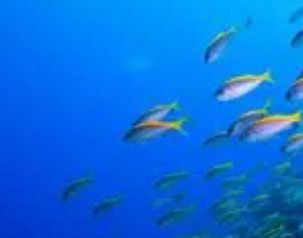
Food resources are crucial for the survival and reproduction of marine animals. The trophic niche of marine organisms refers to the ecological roles and functions in marine ecosystem. It plays an important role in studying interspecific relationship, resource partitioning, community structure and function. In this study, by collecting the relevant research on trophic niche of marine animals, we review current research methods (stomach content analysis, bulk tissue stable isotope analysis, fatty acid profiles and compound-specific isotopic analysis) and their applications by focusing on their corresponding ecological models on quantitively evaluating the breadth and overlap of the trophic niche. Moreover, potential development and directions for further studies are presented, with the aim of providing supports for future research on feeding ecology of marine animals.
With the support of the Ministry of Science and Technology, China joined the International Ocean Drilling Program (IODP) in 1998. IODP-China has so far led the organization of 4+1 expeditions. Through the complimentary proposal project (CPP), Chinese scientists led the drilling expeditions of 349/367/368/368x to investigate the full history of rifting- breakup-spreading of the South China Sea (SCS) basin. In this paper, we summarize the latest achievements of IODP Expeditions 367/368/368x, which revealed surprising evidence for abundant magma intrusion and underplating at the distal northern margin of the SCS as well as rapid continent-ocean transition. Extensive in-depth exchanges and cooperation with the international scientific community have greatly enhanced the operation of ocean drilling platforms, management of the IODP organization, scientific and technical staff training, and public outreach. These experiences will further enhance international cooperation of China's oceanographic research.
As an important expression of Earth’s movement and a migration way for fluid-rich materials from substrates to the surface, mud volcanism and the entrained materials carry with ample information that is important for understanding the geodynamics, stratigraphic lithology, resources, and environment. Featuring thin (~1 km) Cenozoic Erathem and considerably thick (>5 km) Mesozoic Erathem, the Dongsha Waters is deemed as the best but unproven prospect for petroleum sourced from the Mesozoic Erathem. It is also rich with seamounts and submarine hills that are believed as magmatic volcanoes, a potential risk factor for petroleum accumulation. However, it is revealed from recent geophysical surveys that many of the seamounts and hills have developed with remarkable diapiric deformation and faults, fluid infill-led blank reflection zone, fluid seepage, and emission. By sampling with box dredges over tens of seamount and hill, plentiful authigenic carbonate nodules and deep-water corals, sponges, etc., have been collected, which feature them mud volcanoes. Discovery of the mud volcanoes shows favorable conditions for petroleum source and migration over the waters, and provides excellent lines to explore the petroleum and gas hydrates sourced from the Mesozoic Erathem. Abundance of deep-sea coral, sponge and others implies the Dongsha mud volcanoes as potential province for deep-sea coral and sponge reefs, meaningful to study the relationship among petroleum seepage, growth of chemosynthetic community and marine environment.
Creseis acicula, also known as sea butterfly, is marine gastropod adapted to pelagic life. C. acicula is a warm-water marine species and widespread in the world. C. acicula blooms have been found in many waters of the world, particularly in the Indian Ocean. Its bloom was never recorded in the seas of China until 2020. From June to July 2020, an unprecedented outbreak of C. acicula was observed the southwest coast of Daya Bay, Southern China Sea. This bloom lasted for approximately one month. The peak density was as high as approximately 5600 ind·m-3, which is the highest value ever recorded in the world. The C. acicula population was most abundant in waters adjacent to the outflow of Daya Bay nuclear power plant (NPP) located at the southwest of the bay. The outbreak puts a serious threat to the safety of the NPP operation, and therefore has attracted great attentions from the government, scientists and the public. We conducted a continuous monitoring on this event. Since there is very limited information on outbreak mechanisms, we briefly reviewed related research on bio-ecological characteristics of C. acicula; then, we introduced its development progresses in Daya Bay and preliminarily discussed the possible triggers for this outbreak. We assume that the temperature rise due to thermal discharge from the cooling water of the NPP, the fluctuation of seawater salinity caused by rainfall, and the increase in phytoplankton concentration could be the possible factors for this C. acicula bloom.
Seagrass growing in the waters of tropical, subtropical and temperate oceans is an important structural and functional component of the global marine ecosystem and has a high ecological service value. Seagrass is rapidly declining worldwide because of the strong impact of human activities and natural disasters. Therefore, it is a great significance to monitor and protect seagrass resources. With the development of sensor technology, optical remote sensing has shown obvious advantages in seagrass monitoring. In this paper, we review the research status of advanced seagrass remote sensing monitoring at home and abroad, mainly summarizing the research content, technology and methods, and demonstrating the feasibility of seagrass optical remote sensing monitoring. Our aim is to illustrate the suitable data and reliable technical methods for seagrass optical remote sensing monitoring in China, and to suggest potential research directions. This review provides reference for seagrass remote sensing monitoring and expands the thought of scientific management of seagrass resources in China.
As the largest marginal sea in the western Pacific, the South China Sea (SCS) plays an important role in the global ocean and the global oceanographic research. In the past 40 years, chemical oceanographic research in the SCS achieved systematic new discoveries and new understandings; researchers put forward many new theoretical viewpoints, making important contributions to the development of oceanography. A subsurface layer was revealed in the SCS, maximum values of ecological environmental parameters represented by nitrite are present; and the depth ranges of water layers for different parameters are different, forming a thermocline ecosystem that has significantly different characteristics from the other ecosystems. The carbon cycle process in the SCS is very complex, and changes of the biological pump controlled by biological activities, and the regional and seasonal changes of carbon sources and sinks, are all great. The characteristics and intensity of carbon sources and sinks in the SCS are unique in different regions at different times. Annually, the SCS is a weak source of atmospheric carbon dioxide. The characteristics of ecological environment and the cycling process of chemical material in the Pearl River Estuary and deep-sea basins were found not only closely related to but also significantly different from that in shelf marginal seas and coral reefs, as the dissolved oxygen concentration is low in the bottom, and the Pearl River Estuary is basically an ecologically fragile area characterized by hypoxia. Based on the systematic understanding of the rapid material circulation and vertical transfer of chemical substances controlled by biological processes in the Nansha coral reef ecosystem, a new mechanism - “resembling drift-net theory” - was proposed to explain how the coral reef ecosystem could maintain high productivity. Systematic studies on the sedimentary chemistry of the SCS show that there is a close coupling between the sediments and chemical cycling of water bodies. The distribution of chemical substances in coral reefs or in sediment cores of the SCS can be used to retrieve historical environment changes. The paleo productivity of surface seawater in the SCS during the glacial period was 1.6 times higher than that of the interglacial period. A "biological explosion event" occurred in the southern SCS in the late Miocene. The productivity in that period was mainly affected by the monsoon and terrigenous nutrients input, while the influences of northeast monsoon and southwest monsoon differed in different regions. These new discoveries and new understandings in chemical oceanography of the SCS in the past 40 years have laid a strong foundation for further systematic and in-depth understanding of the oceanographic processes in the region. In the future, chemical oceanographic research will definitely provide scientific support for the sustainable utilization of resources and environment in the SCS.
Mangroves are salt-tolerant plants of tropical and subtropical intertidal regions distributed mainly between latitudes 25°S and 25°N globally. They have high productivity, high return rate, high decomposition rate, and high resistance, which cover roughly 60%-75% of the world’s tropical coastlines. Mangroves are distributed over more than 118 countries with a total area near 17 million hectares in the world, and their net primary productivity is up to 2000 gC·m-2·a-1. They form a widespread ecosystem and also play an important role in the process of global change. Global climate change has aroused great concerns in the last three decades. Mangroves are a vulnerable and eco-sensitive ecosystem along tropical and subtropical intertidal shores that are regulated by both lands and oceans. They are one of the typical marine ecosystems that can be affected by global climate change. As an important ecological barrier along the coast, global climate change will also affect the survival and distribution of mangroves in the world. The present paper briefly reviews the impacts of global climate change on mangroves in terms of global warming, sea-level rise, atmospheric CO2 concentration increase, and extreme weather. The ongoing global climate change will bring great challenges and opportunities to research, maintenance, and development of mangroves in the future.
The key project of "Deep Structure survey and study on the Manila subduction zone in the eastern South China Sea (SCS)" was funded from the major research program "Deep Sea Processes and Evolution of the SCS" of the National Natural Science Foundation of China (NSFC) during 2015-2018. This project focuses on the Manila subduction zone to resolve the formation and evolution of the SCS using geological and geophysical methods. Five comprehensive geophysical surveys were successively carried out during the project period with the help of NSFC open cruises. A total of 73 Ocean Bottom Seismometer (OBS) stations and five Ocean Bottom ElectroMagnetometers (OBEM) have been deployed; and 13,872 airgun shots were fired. Totally 60 OBSs and five OBEMs have been recovered, and a large amount of data have been acquired. At the same time, a series of innovative results have been obtained. (1) The crust of the northeastern SCS has been determined as a 12-15 km thinned continental crust affected by volcanic activities after post-rifting phase based on the results of active seismic and earthquake tomography; and its continent-ocean boundary (COB) was also determined. (2) According to the multi-channel seismic reflection profile, the detailed structure of the accretionary wedge front of the northern Manila subduction zone was delineated. (3) The SCS oceanic crust domain when the seafloor spreading stopped has been outlined. (4) The tectonic evolution model of the SCS and the Philippine Sea Plate (PSP) was constructed. This project not only contributes substantially to the key scientific question (age and process of seafloor spreading) of the major research program "Deep Sea Processes and Evolution of the SCS," but also provides important basic data for the "skeleton" of the tectonic evolution and life history of the SCS from seafloor spreading to plate subduction, which has a far-reaching scientific significance.
Anaerobic oxidation of methane (AOM) by archaea in marine sediments is gradually recognized by scientists and is regarded as an important biogeochemical process performed by both methanotrophic archaea and sulfate-reducing bacteria. Our analysis of 16S rRNA showed that multiple kinds of Methanoarchaea including AEME-1, AEME-2 and AEME-3 were the players in the AOM process, and these Methanoarchaea were distributed widely in the oxygen minimum zone of the open ocean. Furthermore, AOM process is related to the global environmental change closely. Most methane leaked from cold seeps of deep sea was consummated by Methanoarchaea in the course of penetrating the deposition layer of anoxic zone; so emission of strong greenhouse methane was reduced greatly. The studies of AOM biogeochemical process should be significant for understanding the formation mechanism of clod seep carbonate, controlling the leaking methane from seafloor, exploitation of combustible ice, and so on.
Mangrove is one of the most important ecological and environmental resources in the world, which can have significant effects including reservation of the organic carbon, accretion of the tidal flat, and protection from ocean hazards. In this study, we reviewed studies of the mangrove tidal flat (MTF) sedimentary dynamics, which involve damp energy and sediment trapping of the MTF, bio-geomorphological behavior of the MTF, and response of the MTF to storm and sea-level rise. We stress that understanding of the MTF sedimentary dynamics should focus on the following scientific questions: attenuation of the coupled dynamics between wave and tidal current along MTF, coupling processes among hydrological dynamics, deposition, geomorphology, and vegetation. Moreover, it is urgent that the study of regional-scale sedimentation processes and driving mechanics of MTF should be intensified in future.
The air-sea turbulent heat fluxes (THFs), including the evaporative latent heat flux and convective sensible heat flux, are key components in air-sea interaction and ocean circulation, which are important for our understanding of the global energy balance, water cycle and climate change. Due to the limitations of observations and numerical simulations, the diurnal variations in THFs are however not accurately known. In this paper, we propose a future research plan toward identifying the mechanisms behind diurnal variations in THFs. With the recent development of traditional buoy observations, new observations (e.g., glider) and newly released atmospheric reanalysis, it is helpful to research the diurnal variations in THFs. Using the combined observations and reanalysis, we investigate the key scientific issues on diurnal variations in THFs under different boundary layer stability based on the bulk formulas and turbulence methods. In the future, we will demonstrate the global basic structures and dominant factors for diurnal variations in THFs, as well as the strength of the diurnal variation associated with the extreme weather processes and climate events. To evaluate accurate magnitudes of THFs for better understanding of diurnal variations, high-frequency surface currents and height-dependent air-sea physical variables will be incorporated into the estimates of THFs in terms of bulk formulas. Innovatively, this study transfers the multi-scale THF variations into the space of boundary layer stability to concentrate on the diurnal variations, which help study the mixed-layer dynamics, upper-ocean ecosystems, energy balance, and climate change.
The development of marine sciences depends on observations. Satellite is one of the most important observation platforms for marine research. Satellite data are of great significance in marine research. Since the beginning of this century, China has successfully launched several satellites dedicated to ocean observations, and preliminarily established a global ocean satellite observation system. According to the basic situation of marine satellite resources at home and abroad, we study and analyze the current situation of the application and development of marine satellite data in China, especially in terms of receiving, processing, management and application of marine satellite data, put forward the scientific research demand for satellite data in China's marine research, and probe into the existing problems and development strategies of the scientific application of marine satellite data in China.
Because of their unique habitat and metabolic pathways, marine microorganisms can produce a variety of bioactive substances with novel structures and functions, which make natural products from these marine microorganisms become a research hotspot of new marine drugs. Combining the methods and perspectives of bibliometrics, we review in this paper the research status of natural products from marine fungi and marine bacteria, the artificial synthesis of natural products of marine microorganisms, the biological activity and druggability evaluation of natural products from marine microorganisms, to clarify the current status and development trend of natural products from marine microorganisms.
The coasts of coral reefs and islands are characterized with very complex wave-current dynamics, unique morphology and largely unknown engineering responses, where wave transformation and wave-induced currents have significant impacts on the infrastructure safety, morphological evolution, disaster prevention, and eco-environmental protection. Recent research advances on these topics are reviewed with respect to three spatial scales, e.g., the large-scale long-wave guiding and trapping, the medium-scale hydrodynamics in a reef-lagoon-channel system, and the local wave-structure interaction. This paper includes the descriptions of, specifically, theoretical findings of guided and trapped waves over ocean ridges and around reef islands, two-dimensional horizontal wave basin experiment of a reef-lagoon-channel system, and new methods to estimate wave overtopping and forces on the seawall based on a large-scale wave flume experiment. Further research prospects are also suggested.
The staff at the South China Sea and Adjacent Seas Data Center, which is a sub-center of the National Earth System Science Data Center, has developed South China Sea ocean database by combining the advantages of ecological environment research domain, the tropical marine environment research domain and the marginal sea and ocean geology research domain, to promote open access and effective utilization of ocean data. In this paper, we introduce our practice in the South China Sea and Adjacent Seas Data Center scientific data construction, which is arranged to share the multi-disciplinary, multi-element and multi-scale marine scientific data in the South China Sea and its adjacent water since 1985, including data of hydrology, meteorology, ecology, and geology. This center will provide high-quality data for research of the South China Sea. It will provide basic data for major national strategies, marine economic and social development and related decision making activities.
Green sea dyke represents a new concept of coastal defense, which combines traditional engineering structure with coastal ecosystem, to cope with the future trend of sea level rise and storm intensification. Before its application, however, the feasibility of such a system must be tested for low-lying coastal areas, where the risk of storm surge, storm-induced waves and shoreline erosion is greatest. The major issue is associated with the process of wave attenuation by the ecosystem and the way of using the ecosystem within the sea dyke system. For many years, wave energy dissipation has been an important research field for tidal flats, a typical environment of low-lying coasts, as well as beaches and rocky coast environments. Theoretical analysis, field observation and physical-mathematical modelling show that the coastal ecosystem indeed plays a significant role in wave energy dissipation: (1) resuspension and fluid mud movement dominate over bed friction in the mud area, in terms of wave height reduction; (2) wave attenuation occurs due to bed friction and bedload transport on the silt-sand flat at the lower part of the tidal flat, while on the upper mudflat it is caused mainly by re-suspension and suspended, fine-grained sediment transport; (3) in the vegetated ecosystems such as salt marsh, mangrove and seagrass beds, the efficiency of plants in reducing flow velocity and dissipating wave energy is higher than that of bare flats, due to plant morphological resistance and stem movement; and (4) wave attenuation is high when passing through biological reefs (e.g., coral and oyster reefs), especially during storms, with bed surface friction and wave breaking being the major mechanisms. Although the wave attenuation theory has been established, the optimization of the way the ecosystem is used within the sea dyke system requires further investigations, especially the techniques of ecological niche reconstruction on eroding coasts and the design of the sea dyke to improve structure safety. The relevant scientific problems include: adaptive biology for salt marsh plants and oysters in conjunction with hard engineering; stability of ecosystem in response to future environmental change; spatial configuration of ecosystem in the green sea dyke and the match between the ecosystem life cycle and the temporal scales of storm events; and the optimization of the sea dyke configuration, on the basis of the equilibrium coastal profile theory.